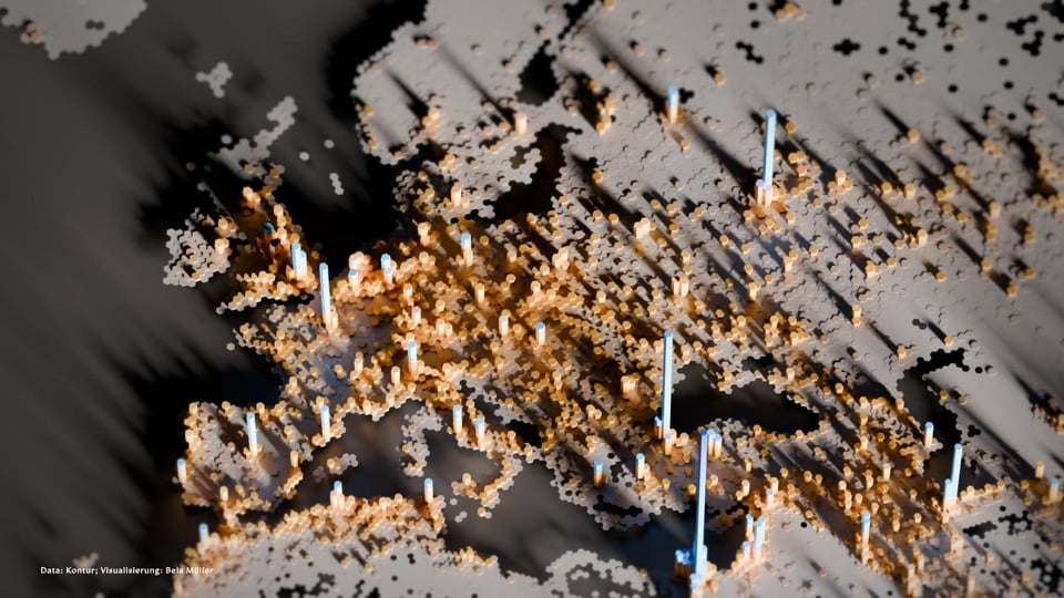
World population
c/map_enthusiasts · u/Blaze@sopuli.xyz · 117 points

Credits: https://old.reddit.com/r/MapPorn/comments/1g821oa/worldpopulation_oc/
c/map_enthusiasts · u/Blaze@sopuli.xyz · 117 points
Credits: https://old.reddit.com/r/MapPorn/comments/1g821oa/worldpopulation_oc/
u/Successful_Try543@feddit.org · 2 points
Me too... I also bet some Canadian would wonder why large areas of his country have dissolved.
u/jlow@beehaw.org · 4 points
I was wondering why there were these big lakes in the Sahara 🤦♀️
u/jlow@beehaw.org · 2 points
Haha, I had the exact train of thoughts as well: "That makes no sense! Unless ..."
u/Successful_Try543@feddit.org · 4 points
Its quite misleading that regions with (almost) no inhabitants have the same colour as the open sea (although, technically, there are also no people living).
u/jlow@beehaw.org · 2 points
Ahhh, yeah, that makes so much more sense!
u/Successful_Try543@feddit.org · 4 points
After looking closely at the cropped image found on reddit, I think the southward pointing notch ('bay') of the Mediterranean is in fact part of the Sahara desert. The blue area next to that then is the Nile delta with the tall peak, Cairo. Palestine then starts next to the dark corner on the right from it.
u/bleistift2@sopuli.xyz · 6 points
The long ‘island’ north of Iceland and the long island to the left are probably the inhabited parts of Greenland. The north of Canada and the North of Russia seem to be very sparsely populated, too. So are the arid regions of Africa and Saudi-Arabia. According to my interpretation of this map.
u/solsangraal@lemmy.zip · 8 points
cool graphic, but why did they decide to make the tall peaks the same color as the "too small for the scale" areas?
u/Gingernate@programming.dev · 3 points
What's with the ugana population?
u/Hegar@fedia.io · 3 points
What's going on with the top of the map?
u/jlow@beehaw.org · 2 points
This is so cool. Istanbul is clearly visible and is that Gaza to the south-east?
u/dsilverz@thelemmy.club · 1 points
[deleted]